Historic Charleston SC

Complete Visitors Guide to historic Charleston SC including maps of the historic district and information on the neighborhoods that make up the historic district.
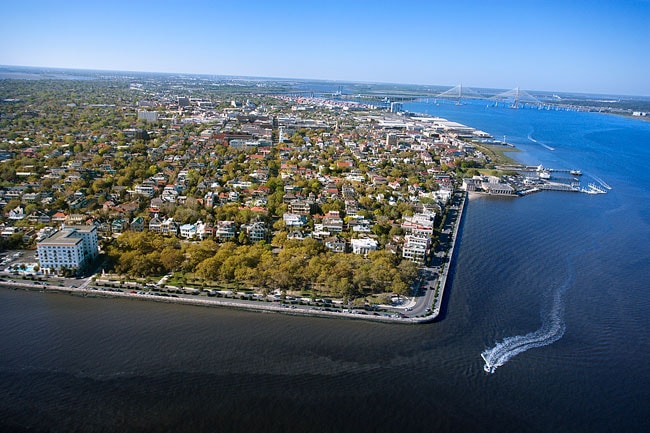
Charleston is the second largest city in South Carolina and has a population of approximately 130,000. The historic Charleston downtown is on a peninsula formed by the Ashley and Cooper rivers, which flow into the Atlantic and are protected from the ocean by surrounding islands. The city is an important port, boasting the second largest container seaport on the East Coast and the fourth largest in North America. Charleston is known as the "Holy City" because of the prevalence of church steeples that dot the city’s skyline, and the fact that it was one of the few places in the original thirteen colonies to provide religious tolerance to the Huguenots and Jews.
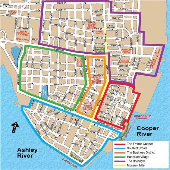
Map of historic Charleston SC
The Charleston Old and Historic District is a National Historic Landmark District in Charleston, South Carolina. The original historic district encompassed everything south of Calhoun Street, but the district boundaries were later enlarged to include areas further north between Meeting Street and King Street (see map below). The area is home to over 1,400 historic structures, with an unparalleled collection of 18th and 19th-century architecture. Built of brick, stucco, or clapboard, many of these structures are Charleston “single houses,” one room wide, with a gable end to the street and tiered piazzas. Others are plantation style houses. Architectural styles include Georgian, Regency, Federal, Adamesque, Classical Revival, Greek Revival, Italianate, Gothic Revival, and Queen Anne, among others. The district also contains many outbuildings (stables, carriage houses, kitchen buildings), many of which have been extensively altered to accommodate modern needs.
The five neighborhoods of historic Charleston SC

The Charleston Peninsula is made up of 5 distinct neighborhoods: The Boroughs, Harleston Village, The Business District, also called the Shopping District, The French Quarter and South of Broad.
- The Boroughs - The Boroughs are made up of 4 small neighborhoods:
Radcliffeborough - Located next to the Medical University of South Carolina, this area is home to doctors, professors, college students and other professionals. Columned antebellum mansions share streets, with modern homes merging the old and new. Biking and walking are popular forms of transportation in this borough, with its proximity to shopping, dining, and cultural nightlife.
Ansonborough - This area, surrounded by the historic Charleston Market, Waterfront Park, and numerous hotels, was the first suburb of the original walled city of Charles Town. Home to the oldest private residence, the Col. William Rhett House dates back to 1712. Charming deli’s, shops, and full-scale restaurants line the streets of this vibrant neighborhood.
Cannonborough/Elliotborough - These were originally considered two separate boroughs, but are now regarded as one. This area has been undergoing revitalization over the past several years, and has seen many unique restaurants, bakeries, and small boutiques popping up in the "Midtown" area around Spring St. and Cannon St. Mazyck-Wraggborough - This borough is bordered by the Charleston Visitors Bureau, the Galliard Auditorium, and the Charleston Maritime Center. Located along a portion of Charleston's Museum Mile, Mazyck-Wraggborough offers convenience to many cultural hot spots in Charleston, including the Charleston Museum, the Children’s Museum of the Lowcountry, and the Charleston Music Hall. - Harleston Village - Bordered by the College of Charleston and the Medical University of SC, Harleston Village is a lively and diverse area of downtown. This highly pedestrian friendly area of town has parks, corner cafes, boutiques and bars.
- Business District - The Business District is home to some of the best antique shops in Charleston. You can find furniture, porcelain, silver and art dating back to the late 1700s. This area is also home to the Fashion District.
- French Quarter - The French Quarter was settled in 1680 and gets its name from the many French Huguenots that settled in the area. This neighborhood is famous for historic churches, art galleries, restaurants, and Waterfront Park.
- South of Broad - South of Broad is the most exclusive part of downtown Charleston. This quiet residential area has cobblestone streets, stately antebellum mansions, and manicured gardens.
For other helpful maps, including maps to help you locate public restrooms, public parking garages, beaches, and attractions, visit our historic Charleston Maps page.
Learn More: Charleston SC Maps
Weather in Charleston SC

Charleston has a humid subtropical climate with warm summers and mild winters. The daily high temperatures average around 75°F and daily low temperatures average around 56°F. The hot season runs from May 27th until September 18th, with July 23 being the hottest day of the year. The cool season runs from December 1st until March 2nd, with January 17th being the coldest day of the year. Charleston experiences high dew points for about 6 months of the year, from the first of May until the end of October. During these months, the humidity comfort level can range from muggy to oppressive.
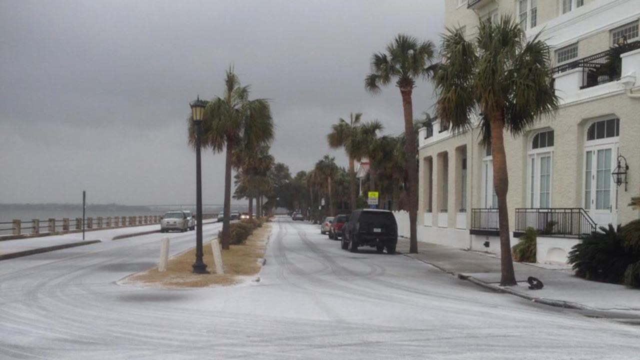
Although Charleston is pretty far south, the city experiences a rare snow day. On January 3, 2018, its first significant snowfall in years blanketed the city. The Charleston International Airport received over 5 inches of snow, while many other neighborhoods on the peninsula received anywhere from 2-5 inches. Area schools, businesses, roadways and even the airport were forced to close due to dangerous driving conditions. It took several days before life in Charleston returned to normal.
| Sunny Days | 209 |
| Overcast Days | 156 |
| Days with Precipitation | 119 |
| Average Yearly Rainfall(inches) | 50.9 |
| Days with temps above 90° | 53 |
| Number of sunny days during an average summer month | 18 |
| Number of sunny days during an average winter month | 15 |
| Wettest months | July & August |
| Driest months | October & November |
| Hottest Month | July |
| Coolest Month | January |
For further information on Charleston weather, including monthly average temps, monthly average precipitation, and seasonal conditions, visit the Charleston Weather page.
Learn More: Charleston Weather
- Home
- About Charleston
Copyright © 2009-2025 visit-historic-charleston.com

